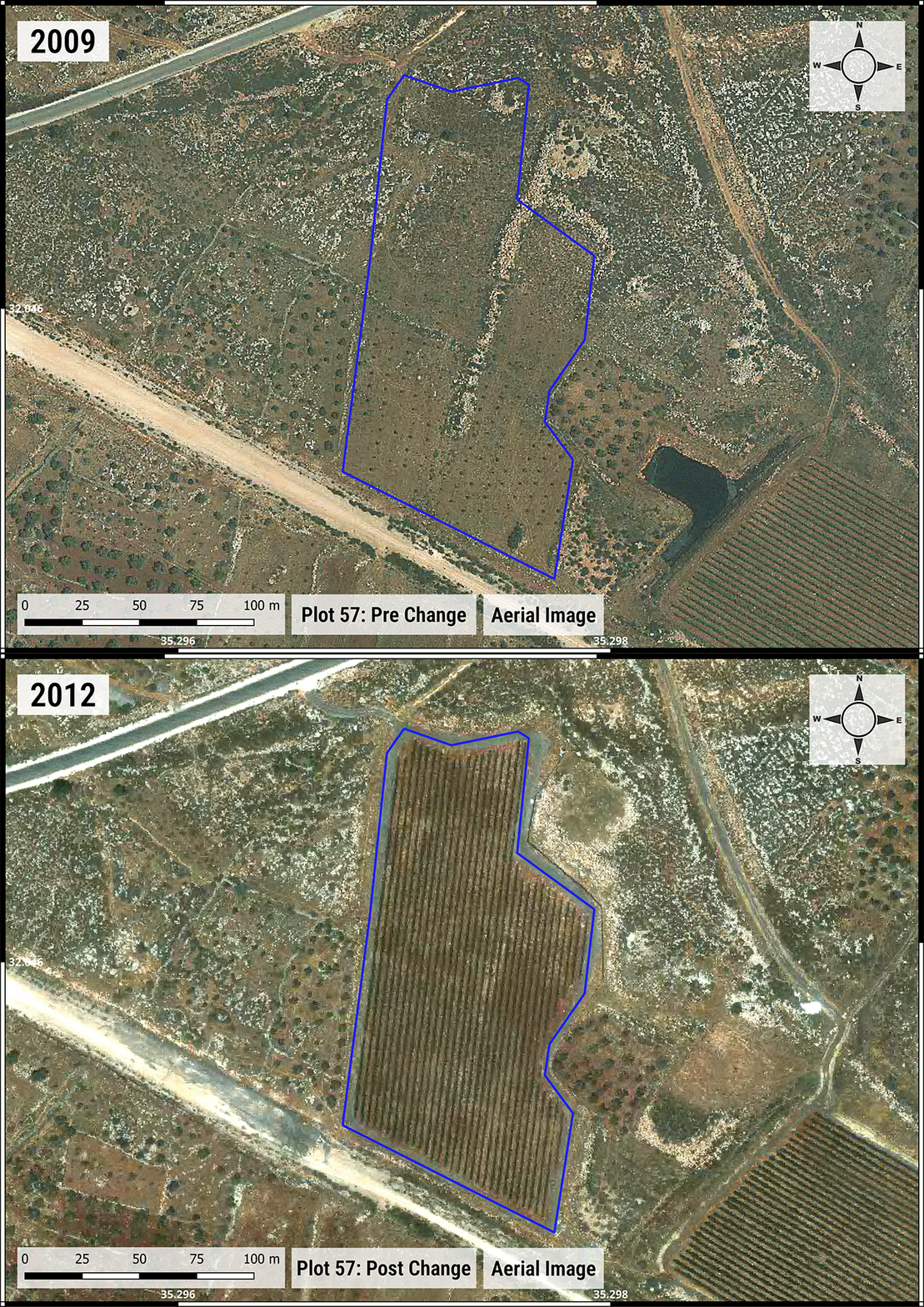
On a multispectral satellite image of the West Bank, Ramón Bieri, an analyst at SITU Research, shows me how to watch the vineyards. A box in the bottom right-hand corner displays the year, beginning in 1984. As the map moves forward in time, orange and yellow spots, inside the blue outlines, shift to deep green and eventually spill out beyond their squiggly boundaries.
Bieri explains to me the variegated colors represent vegetation signatures and the time-lapse displays olive groves, and other untended land, transforming into neatly rowed vineyards. The underlying map, he says, shows areas of the West Bank where Israeli settlers have forcibly taken over Palestinian villages. The colors I am watching are not simply a record of agricultural planning. It is, SITU Research Director Brad Samuels claims, empirical evidence of apartheid.
Prosecuting the crime of apartheid is tricky in any context, but especially in the Occupied Palestinian Territories. SITU believes this novel technology could finally unlock legal cases that have long eluded activists in the West Bank.
In July, the International Court of Justice (ICJ) delivered an advisory opinion declaring the Israeli military’s occupation of the West Bank, East Jerusalem, and Gaza illegal and suggesting that its policies and practices amounted to a system of apartheid. Organizations such as Amnesty International, Human Rights Watch, Al-Haq, and B’tselem—not to mention Palestinian activists themselves—have drawn similar conclusions. As HBO’s John Oliver recently pointed out, even prominent Israelis, including former prime ministers Ehud Olmert and Ehud Barak, as well as a former Mossad chief and a former IDF general, have deployed the term “apartheid” when describing the Occupied Palestinian Territories.

Some find apartheid a harsh characterization. In a recent interview with Ta-Nehisi Coates, New York Times columnist Ezra Klein said the term was “appropriate” but worried the label would “shut some people’s minds down.” It leads the conversation, Klein worried, into the “technical.” The “technical” minutiae of definition may be ill-suited to the conversation Klein hopes to have, but it is fundamental to the legal mechanisms of proving and prosecuting apartheid in international courts.
The technology, an expert said, may make it possible for prosecutors to secure the first apartheid conviction in history.
Over the past few years, a growing chorus of states, human rights organizations, and international legal bodies have applied an apartheid legal framework to the Israeli occupation, hoping to seek justice. Yet no one has successfully prosecuted allegations of Israeli apartheid in any jurisdiction.
Samuels, along with collaborators from Israeli human rights organizations Yesh Din and Bimkom, and researchers at Princeton University’s Department of Geosciences, hope to change that. In his West Bank investigation, Samuels is one of many researchers attempting to actually prove the existence of a widespread, systematic regime enforcing one group’s dominance over another in a way that could be accepted by legal systems.
For the past nine months, the team used remote sensing methodologies and satellite imagery to document three hallmarks of apartheid in the West Bank: land dispossession, restriction of access, and forced displacement.
To Samuels, the body of evidence they have amassed so far is moving “towards an evidentiary file” for prosecutors everywhere. It’s a proof of concept, one that he and his collaborators hope will encourage apartheid litigation across domestic and international jurisdictions.

The project began in the summer of 2023. Michael Sfard, an Israeli lawyer and activist with Yesh Din, met up with Samuels in New York while on an advocacy trip in the United States. The two had known each other since 2009, when Sfard enlisted Samuels to help him with the case of Bassem Abu Rahma, an unarmed Palestinian man attending a nonviolent protest in the West Bank whom the Israeli military killed with a tear-gas canister.
Over breakfast, the two discussed a legal opinion Sfard had published on apartheid. As a litigator, Sfard could easily point to evidence of apartheid in law books and testimony. But Samuels, an architect and visual investigator, was curious whether apartheid in the West Bank had any spatial representations. In other words, how can we see apartheid?
Spatial representations of apartheid aren’t new: photographer Johnny Miller’s famous drone footage, for example, shows the legacy of South African apartheid and segregation through stark aerial images of wealthy, verdant neighborhoods on one side of an invisible line, and crowded plots of shacks on another. But the legal fight has been more complex.
No one has ever been prosecuted for apartheid—not even in South Africa. As international law scholars Gerhard Kemp and Windell Nortje wrote, “There remains a significant accountability deficit pertaining to this crime against humanity.”
Defined by the Rome Statute of the International Criminal Court, apartheid is not only specific but multilayered. It is “inhumane acts…committed in the context of an institutionalized regime of systematic oppression and domination by one racial group over any other racial group or groups and committed with the intention of maintaining that regime.”
These specific elements can put successful litigation of the crime out of reach even for skilled prosecutors in favorable jurisdictions. “You have to prove things like a special intent of domination by one racial group over another,” Kemp told me, “which is more difficult than, say, using the same facts to prosecute war crimes.” Then there’s the added challenge of collecting evidence under an occupation that limits outside access and keeps Palestinian institutions weak—all in the midst of war.

Sfard told Samuels that even with dossiers of testimony evidence, it can be nearly impossible to get remedies for their Palestinian clients in domestic Israeli courts. “Justice for Palestinians whose lands were taken does happen—but at the rate of miracles,” Sfard said. “It’s not a neutral court. We’re not in the Hague. We’re not in some Swiss Tribunal. It’s the court of the occupier.”
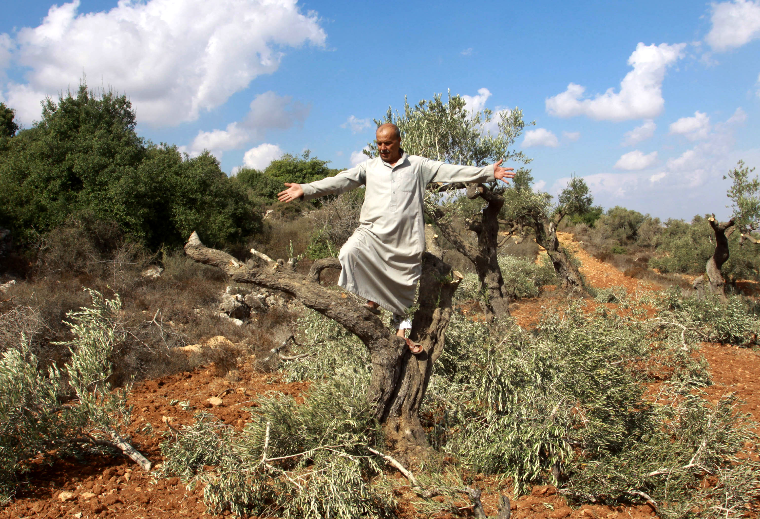
For decades, legal systems have grown more skeptical of subjective human accounts in general, as scientific approaches and forensic evidence became the “evidentiary holy grail,” said Sfard. This is especially true of Palestinian testimony in Israeli courts. To prove apartheid in court, Sfard explained, this meant olive groves could be key. In the West Bank, settler expansion is all about land. “When settlers take over Palestinian land, they uproot it and plant their own stuff,” Sfard said. “And I told Brad this is, for example, one thing we can see.”
There are exceptions, but typically Palestinian farmers cultivate olive groves using traditional methods, and settlers build industrially irrigated vineyards. Samuels and Sfard hypothesized that this distinct cultural approach to agriculture could serve as a reliable proxy for land dispossession—one of the essential components of the apartheid system—and that remote sensing technology could detect these changes over time from space.
Documenting this is not as simple as firing up Google Earth Pro. Satellites can produce imagery with a resolution high enough to make out neat rows of grape leaves versus patches of olive trees. But this documentation only dates back a few years—long after the point in the late-1970s when the settler land grab dramatically increased. Other restrictions, such as the Kyl-Bingaman Amendment, also limited the quality and availability of US satellite imagery over Israel and the Occupied Palestinian Territories from 1997 until the law was repealed in 2020.
Samuels and his team brought the puzzle to Adam Maloof, a professor in Princeton University Department of Geosciences, and Ryan Manzuk, a researcher who recently obtained his PhD from Maloof’s department. Though access to satellite imagery with high spatial resolution was limited, they realized that one particular US government satellite called Landsat provided free access to high spectral resolution imagery, which uses colors and wavelengths undetectable to the human eye. With Landsat’s Normalized Difference Vegetation Index (NDVI), the team could track differences in vegetation health and lushness over time, allowing them to differentiate vineyards from olive groves in areas of the West Bank dating back to Landsat’s launch in 1975.
Landsat had another advantage: evading the Kyl-Bingaman Amendment restrictions. “It’s a blind spot,” Samuels said. “The government scrambled US space agency satellites that had high spatial resolution, but not high spectral resolution, probably because they didn’t perceive Landsat as a threat.”
The team then narrowed their investigation to three villages that illustrated different aspects of apartheid: land dispossession, restriction of access to land, and forced displacement. “There are all different kinds of ways in which settler expansion presents itself,” Samuels said. “And the fact that we focused on three really was a function of time, resources, and fit, in terms of remote sensing.”

When Samuels and his team presented their initial analysis to Sfard and Yesh Din, there was a long silence. “This is remarkable,” Sfard remembered a colleague finally saying. “This is science fiction come true.”
Still, he could not help but feel the remarkable dissonance between believing Palestinians and having to show it on a map: “We already know all of this,” he said. The maps could corroborate testimony in a scientific, clinical way. “It was like a new set of glasses was placed on our eyes, and we suddenly saw more,” he said. But, with it, there was still a realization that Palestinian voices would not be believed without overwhelming evidence.
Sfard hopes that with this new tool, the courts, both Israeli and non-Israeli, will also start to see more—or at least differently. Now, when alleging that the Israeli government declared a parcel of land as state property and allocated it to settlers, “it’s not just the head of the village that is telling you this and making this allegation,” Sfard said. “We have scientific proof that this is the history of it.”
Apartheid has been firmly established as a crime against humanity for decades. And some hope to expand it, including new distinctions like gender apartheid. “But the difficulty,” Kemp explained, has been “to apply the legal standard to the facts on the ground. And this is where the project comes in.” Kemp said that SITU and Yesh Din may make it possible for prosecutors to secure the first apartheid conviction in history.
The ultimate goal is for prosecutors to apply this new approach in courtrooms, but the project faced its first test in a German museum. On October 8—just a day after the one-year anniversary of the October 7 Hamas attacks—the project premiered as one of several case studies in a new exhibition called “Visual Investigations: Between Advocacy, Journalism, and Law” at the Architekturmuseum der TUM in Munich. SITU’s corner of the exhibition centers around a giant map of the West Bank, sprawled across a 25-foot long wall, with time lapses of land dispossession, archival photographs of olive groves and Palestinian farms, videos, and a lengthy methodology section.
“I wanted to make clear that this is a super-focused, very specific, and rigorous unpacking of the question of the manifestation of apartheid,” Samuels said. “And not just an ideological rant.”
After Samuels walked a crowd through the findings and dense methodology on opening day, an Israeli student who had concerns about the project during its planning phase approached him. In an emotional exchange, she expressed her gratitude over the fairness and rigor with which Samuels and his collaborators approached the investigation.
Exchanges like that one make Sfard hopeful about the investigation’s potential, but he is careful not to let forensic analysis eclipse the human element.
“Palestinian accounts of the crimes committed against them are of utmost importance,” he said. “While I’m ecstatic about the project, and I think that its fruits are extremely important, they do not replace the direct Palestinian account. I hope that this project will not only allow us to prove in a court of law that certain land was dispossessed, but will also give Palestinians a stage to tell their story.”


